
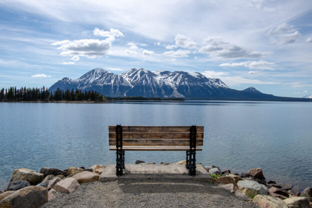
A planner’s journey: what happens where the road ends…?
How does it feel to reach the end of the road? How do local communities live there and organise their common spaces? And what are the sustainability challenges in those places and their regions? Between May and July 2026, I had the opportunity to explore a larger part of Western Canada within the provinces of British Columbia and Alberta and the Yukon Territory.
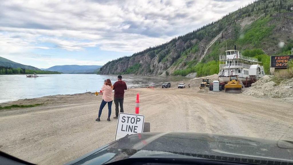
11,111 km on the road took me to remote areas, to hidden and deserted places as well as to overcrowded touristic sites, to capital cities and into almost forgotten settlements. A common theme moved around boom and bust, growth and decline, and the quest of small villages and communities for their independent futures. Multiple times, I reached villages and small cities at the end of the road. Only turning around and travelling back was an option for most of their history or is still today. These places are often less central on tourist maps and less regular destinations for private or business travels, for new businesses, or for people relocating. This will be the selective focus here. The following reflections are based upon many unexpected, expected, and planned encounters, talks with locals, immersing into the respective villages, shops, and hotels or campgrounds, brochures, notes, and a collection of 10,679 photos on mobile phone (Samsung) and single lens reflex camera (Pentax K-3 Mark III).
For 58 days (from 12 May to 9 July 2026), I went through places in the triangle between Vancouver (British Columbia), Dawson City (Yukon Territory), and Edmonton (Alberta). The tour started in Vancouver and took me to Vancouver Island and then all the way up north to Dawson City, where the regular road ends and only a seasonal ferry takes travellers across the Yukon River and further into Alaska. From there, back along the Alaska Highway to Dawson Creek and further to Edmonton, and turning westwards via Banff National Park and the Okanagan Valley to Vancouver. Twelve days in Vancouver complemented the roundtrip at the start and at the end of it. The time in Canada finished with two additional weeks with visits to Toronto and Sudbury (Ontario), Montreal (Québec), and Halifax (Nova Scotia) at the other side of the country. Altogether, I have been through Canada from 6 May to 29 July 2026.
A tourist’s view to the ups and downs of attention
A Canadian road trip story should start with a short tourist view. And I must admit: what a beautiful, welcoming, and inspiring country! From the large cities of Vancouver, Edmonton, Toronto, Montreal, Sudbury and Halifax, to wonderful medium-sized ones like Whitehorse, Victoria, Smithers, Hinton, Revelstoke, Kamloops, and Penticton, to small villages and the wide landscapes of British Columbia, Alberta, and the Yukon Territory, up to mountain ranges and rivers in Rocky Mountains and Coast Mountains. Entering the Yukon Territory on 1st June made it even more special: the last ice was still on the lakes, the days went up to beyond 20°C, daylight hardly vanished, and the mosquitoes have not yet been awake and active.
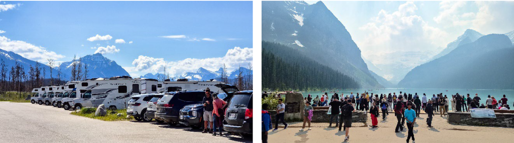
On the other hand, even with rosy eyes of a tourist, extremes are visible. Empty places with huge stunning landscapes but hardly any residents and visitors alike. But, often even in relative proximity, places of overtourism where enjoying nature becomes a pure social media performance. Extremes to the first have certainly been in parts of Northern British Columbia and besides the main roads in the Yukon Territory, but also in places like Grande Cache in Alberta.
The other extreme are places like Lake Louise and Banff National Park or Maligne Lake within Jasper National Park. I did not even dare move to Banff itself. One night on a campground in Lake Louise was just enough to hike up to the lake and experience what overtourism is like. Shuttles up cost close to 100 Canadian Dollars or are sold out months in advance, and parking requires driving up before sunset and still paying 42 Canadian Dollars. Is it worth it? For Instagram or TikTok probably yes – if you manage to get the right angle. An easier or more fun spot for taking photos of tourist masses and their behaviours than of untouched nature. For pure nature experience, there are equally good places elsewhere.
A planner’s view towards the end of the road
From here on, I want to focus more on my spatial planner’s view. Holding the hope other planners share it and can follow, and non-planners use it to reflect and question. Besides beauty or tourist stories, the tour sharpened my eye for spatial and planning challenges in Canada and its cities, regions, and villages. Housing crisis, transport problems, poverty, and homelessness are visible in many cities and sweep to medium-size and small ones.
Growing metropolitan regions face massive and contested (international) housing and development projects. Large cities like Vancouver and Edmonton also face pressing planning challenges in domains like housing, infrastructure, and health. There is much to say – but maybe in a further and separate text. Simultaneously, population and economic activity fluctuate or decline outside of urban regions. Returning large-scale mining and pipeline projects change vast landscapes and communities. Remote areas with lovely communities find themselves in continuous quests for own future directions. What is the potential scope of action for (regional) spatial planning to lead forward where the road ends?

I have seen remote villages and communities with their own challenges, but also unique strengths and particular attractions. I want to reflect on the following selection in order of my visit to them:
- Tahsis (British Columbia) on Vancouver Island.
- Powell River (British Columbia) on the so-called Sunshine Coast.
- Stewart (British Columbia) bordering the United States of America.
- Keno City and Mayo (Yukon Territory) along the Silver Trail.
- Dawson City (Yukon Territory) in the heart of the Klondike Gold Rush.
- Atlin (British Columbia) at the edge to the Yukon Territory.
- Grande Cache (Alberta), at the so-called “Scenic Route to Alaska” from Hinton.
- Nordegg (Alberta) at the boundary into Banff National Park.
- Naramata (British Columbia) at Lake Okanagan.
What many of them have in common is a foundation and a history in mining (Stewart, Atlin, Keno City, Mayo, Dawson City, Grande Cache, Nordegg), in forestry, logging, and wood processing (Tahsis, Powell River) and in fruit production (Naramata). These villages share a history of both remoteness and connectedness. Remoteness for their location and challenges to reach them, which was often limited to long and demanding travels, only possible in certain seasons, or only by few means of transport. Connectedness because they had resources that were in high demand often far away and gained both wealth and relevance far beyond their own regions. The prime example is Dawson City and the Klondike Gold Rush (1896-99) that became known almost globally. Keno City brought large amounts of silver and other metals over decades. Powell River delivered paper for newspapers many people around the world have read. Except for Grande Cache and Nordegg, they still all lie at the end of regular roads with limited access from other ways (e.g., ferries, airplanes). Boom and bust are not only key words, but actual lived realities for these communities in their past, present, and futures.
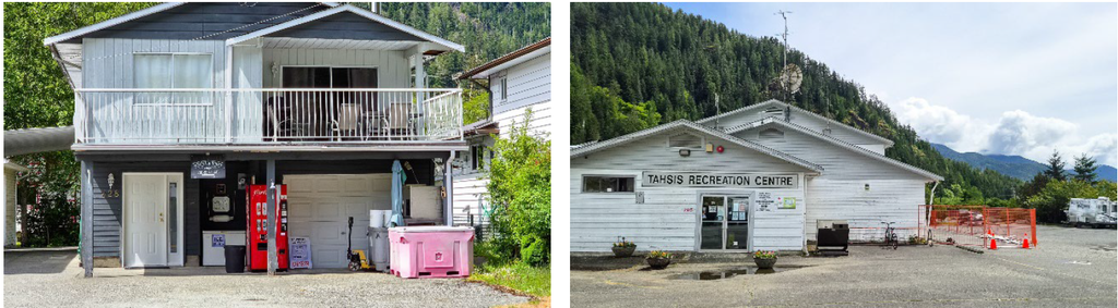
Tahsis (British Columbia) lies at the end of a road that only opened in 1972 and connected to Gold River. More recently, it became marketed as “Tree to Sea Drive”. The largest part of the 64 km Forest Service Road is a gravel road. The entry sign at the road welcomes with “Birthplace of British Columbia” due to its location close the point in the Nootka Sound where First Nations met James Cook in 1778. Logging and sawmilling led to around 2,500 inhabitants, but the sawmill finally ceased operations in 2000. Population decline led to below 400 permanent today and a seasonal population during summer reaching around 1,500 people in the village municipality.
At the other side of the village, literally the end of the road, a coffee roastery has opened. When I asked a resident on a short hike before entering the village, the coffee roastery is the only place worth visiting. I would not agree with that, but certainly to the great quality of the coffee and its unique location. It lies next to a boat launch where a few cyclists or hikers take connections for multi-day hikes along the coast (e.g., the five-day Nootka Trail). In late May, tourist season had not yet started and a local approached on the street to start a conversation with “Young people here? What are you doing?”.
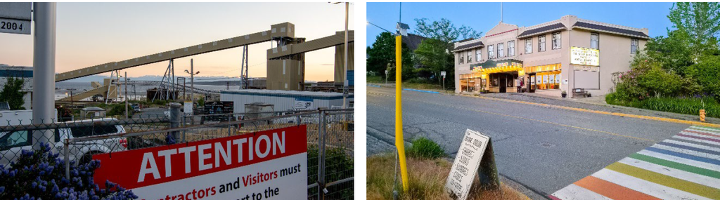
Powell River (British Columbia) lies on the northern Sunshine Coast. The historic townsite developed as a company town around a large paper mill. It became a National Historic District in 1995, while the paper mill finally ceased its operations in 2023. The whole city has just below 14,000 residents today and is structurally moving towards tourism due to its location, while the historic townsite struggles to find an enduring new identity.
History of the paper mill in Powell River started in 1909 but reached its peak between World War I and II with up to 3,500 workers and became even the biggest in the world. It underwent several mergers and ownership transfers after 1960 and declined to 360 workers before its closure in 2021. Global News Canada reported around the closure in 2021 that 4 % of all newspapers worldwide were printed on paper from Powell River.

Stewart (British Columbia) lies at the end of a 65 km detour from the Steward Cassiar Highway and just before the border to Hyder (Alaska, United States of America). Hyder is only accessible through Canada or by ferry. The road was built in the 1960s and extended as a highway in 1984. Mining activities closed already in the 1980s with forestry remaining. The population of the district municipality is around 500 residents, while estimates reach up to 10,000 people during the greatest boom time in the early 1900s.
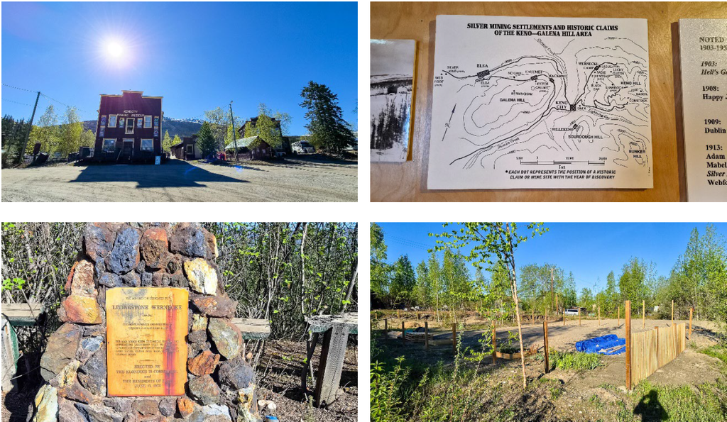
Keno City and Mayo (both Yukon Territory) lie along the so-called Silver Trail, together with a fully abandoned and closed former company town Elsa. The Silver Trail is a highway of 112 km from Stewart Crossing (the main connection between Whitehorse and Dawson City) and connects to Mayo (56 km) and Keno City (121 km). Elsa reached around 700 inhabitants but shut down operations in 1989, with few remaining activities in the area and no remaining parts of the old settlement. I camped on Five-Mile Lake campground just north of Mayo. Only two sites were used over night, but the lakeshore was populated in the evening by mining and construction workers using the first warm evening of the year.
Mayo lies along the Stewart River. The village hosts just below 200 residents today, down from almost 500 in 1966. It once had summer connections by Sternwheelers towards Whitehorse and Dawson City, but the last services stopped in 1951 (and in 1956 also on the Yukon River). Keno City’s history started in 1919, and it became a town in 1922 with basic services like hotel, post office, and stores. It went down to a single resident in the 1980s with around 20 permanent residents counted now. Large-scale open pit mining is re-opening around the area around Elsa and Keno City (Keno Hill Mining Site).
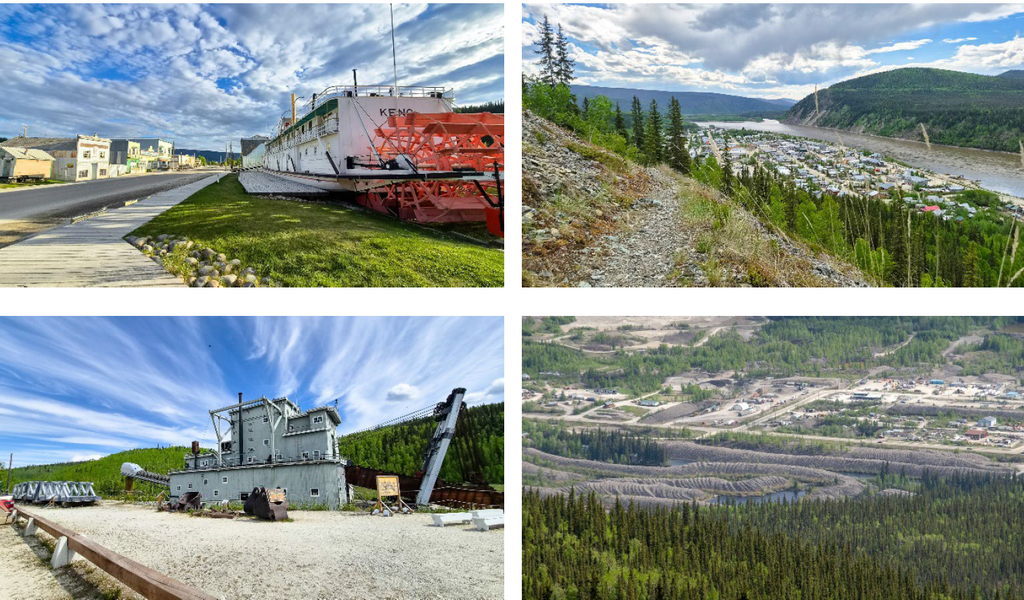
Dawson City (Yukon Territory) was the heart and destination of the Klondike Gold Rush. A considerably short boom period with about 100,000 stampeders heading north from the United States of America between 1896 and 1899. It led to a population high of around 30,000 people, which quickly declined afterwards. Today, around 1,600 people live permanent in the city, with a high summer peak of more than double the number. The travel guide advised considering flying to Dawson City as the 530 km road from Whitehorse has little to offer – a false advice, and I would have missed memories to places like Carmacks, Moose Creek Lodge, and not the least Mayo and Keno City.

Atlin (British Columbia) lies at the shores of Atlin Lake and is only accessible by a regular road from the Yukon Territory. The unincorporated community has just below 500 permanent residents, while around 3,000 people or more lived there during the short 1898 gold rush. In 2025, mobile phone network (5G) and glass fibre internet reached the village. It seems to have strong community bonds, and I got into multiple conversations in local stores and during breakfast. The hotel breakfast rooms served also as a community place to have a coffee and warm up instead of turning the heating on at home.
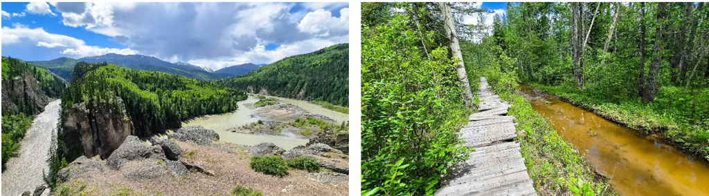
Grande Cache (Alberta) developed around coal mining with a large mine established in 1966 and still active. In this collection, it is the only new town that was developed in a planned way after the Second World War. The population peak reached almost 4,500 people in the mid-1990s but declined to just above 3,000 residents today, leading to financial struggles and dissolving the status of town in 2019 to a hamlet within the District of Greenview. The highway continues through Grande Cache since 1986 and the village is no longer the end of the (regular) road. It was finally paved in 1995 and now announced and marketed as the “Scenic Route to Alaska” from Hinton and Jasper National Park.
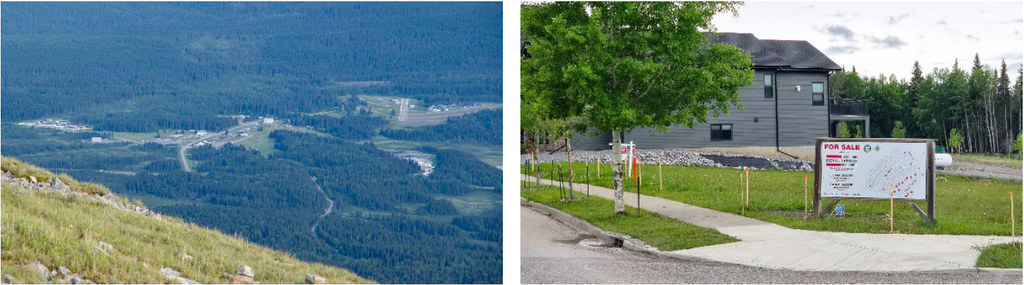
Nordegg (Alberta) started as a mining camp after Martin Nordegg found coal deposits in 1907, with production beginning in 1911 and the railway line connecting the site into Alberta opening two years later. It was a planned community with a sudden end with full closure of mining in 1955 following the first oil discovery in Alberta in 1947 (Leduc No. 1). The population had reached almost 3,000 residents but plummeted to only two dozen.
The highway through Nordegg into Banff National Park opened in 1975. On old road maps from the 1980s, Nordegg was no longer mentioned. A limestone quarry began its operations next to the village in 1983. Recently, tourism and housing developments started again and ca. 100 residents are registered in the hamlet that became a part of Clearwater County. A hostel (HI Nordegg Shunda Creek Wilderness Hostel), where I stayed for two nights, opened around 2006 at the end of a 4 km cul-de-sac and has recently been renovated.
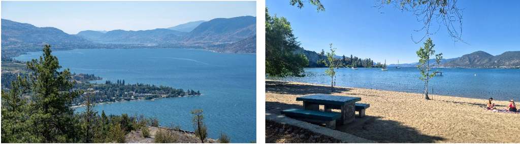
Naramata (British Columbia) is an outlier with its economic base in fruit production. It lies at the Lake Okanagan in Southern British Columbia and was connected via the Kettle Valley Railway that was operational between 1914 and 1973. The tracks have been removed in 1991, and it became a cycling track used by tourists starting from Penticton. The unincorporated community has around 1,600 residents and, with ups and downs, the number is close to historic peaks. The community seeks a future in tourism and agriculture. It follows the Cittá Slow (Slow Cities) movement, and a group of residents aspires to become the first Dark Sky Community in British Columbia.
Later in July, I was able to complement the list with a short visit to Sudbury and Copper Cliff (Ontario), one of the world’s largest mining complexes in the Sudbury Basin. The city is important for Canadian mining history and remains a very important and active site especially for nickel and copper today. It does not share the same characteristics as the previous smaller villages as such. However, parts of Sudbury (e.g., Copper Cliff) resemble the developments and challenges.
Observations: Where the road ends…
Summarising what has become visible and obvious across different villages with their particularities is not simple or straightforward. My observations followed both curiosities, the unavoidably lens of a spatial planner on any visited place, and the critical questions a researcher interested in roles of planners and post-growth planning bears in his mind. I have tried to distil eight common messages that link between observations, discussions, and my own interpretations.

First, visible almost everywhere are strong ties between local community members, beyond socio-economic divides. Remote locations play a role, but even more harsh winters. Atlin looks calm but can have storms and bitter cold winters. Electricity workers have been in the village during the visit, coming from their closest service location in Dease Lake – more than 650 km distance (one way). Local shops (witnessed in: Atlin Lake Grocery Store / Food Basket) serves as computer service to locals, discussion stop, connection point, and more. The only hotel (Atlin Mountain Inn) serves as post office, breakfast location for locals, restaurant (coordinated hours with the only other restaurant in town) and saloon. Shopping for a community Barbecue at the weekend means: at least 180 km (one way) by car to Whitehorse and back.
Life does not work in anger and isolation in an isolated settlement. Visible across end of the road locations is local community care for walking paths – from regular maintenance to individual chairs or benches brought to remote locations to enjoy. Quality was sometimes even better than in the next larger cities.

Second, continuous challenges are posed by being at the edge of reach for public services. Basic public services are available. Even small remote villages serve for their surrounding and at least a basic shop, petrol station, post office, community and recreation facilities and primary schools have been visible and active. But what gets beyond daily needs becomes more problematic. Moving a couch to Dawson City? An intense challenge, as someone explained vividly. The nearest city is ca. 530 km away: Whitehorse, capital of the Yukon Territory with 39,000 inhabitants (which accounts for 90% of the total population of the vast territory).
In Stewart, calling an ambulance is possible, but it might take hours to reach you. Having sports tournaments is way beyond an afternoon or evening ride. On the other hand, it had a good Mexican restaurant that features a unique toaster museum integrated in its rooms. Reportedly, visitors come as far as from Terrace, Hazelton or Smithers to eat there – between 260 to 330 km one way. Grande Cache has public services available, but visibly struggles with an oversized shopping mall, aging buildings, and new perspectives. Even places like Mayo and Dawson City now begin to focus on community gardens to secure and diversify food sources (e.g., reported also in The Yukon Magazine, Summer 2026, about the community garden initiative by the Yukon Food Bank Society). On the other hand, the season is extremely short from late May into early September and the potential thus limited to certain produce.
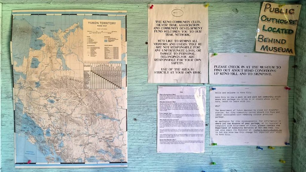
Third, there is a good deal of attractiveness for totally different people and activities due to remoteness, isolation, and/or affordability. Most of the above-listed have a comparably old population. However, for two separate reasons. First and more obvious, residents growing older while birth rates decline or younger people move further away for education, jobs, or other opportunities. Second, villages like Atlin, Tahsis and Keno City have become attractive for different types of people seeking their intendent futures outside of a crowded and hectic society. The Keno City Snack Bar reportedly makes the best pizza “between Whitehorse and Dawson City” but only opens when the owner is occasionally there.
Keno City does not have any public services, not even a garbage collection but its isolation attracted its two dozen of residents since the 1980s. The city still holds the annual Keno City Music Fest – announcing on their posters to bring water and food, but that camping is free. Some residents moved out more recently with the reopening large-scale mining and changing landscapes. There are even connections across the sites I have visited, such as a photographer (Insa Schultenkötter) first moving to Keno City and then to Atlin, in both locations engaging with local history and sharing knowledge and beauty. I only realised later that many photos in brochures in Keno City and in Atlin, like the “Exploring Keno Hill: Stories of a Silver Deposit” (2004, reprinted 2021) make intensive use of her work.
Grande Cache become home to the “Canadian Death Race” since 2000, reaching for 118 km through the Rocky Mountains around the village, and connected to the effort of residents to revive the area. I first recognised the existence of the race at the Sulphur Gates with a view on the confluence of Smoky River and Sulphur River: a hiking trail crosses the river in OpenStreetMap that was nowhere visible, nor doable for a regular hiker. Around 1,000 registered runners participate now in the 42 km Half-Death Marathon or the full race. More remote, more extreme.

Fourth, very visible is that history is present in many daily actions and symbols today. All villages kept monuments of their past and in honour of past hard work and workers. These are monuments honouring minors (e.g., in Dawson City and Keno City above) or hard lives and losses (e.g., the old cemetery in Atlin). Given the small populations and remote locations, all of these have been well-maintained over decades. The most striking examples to me have been the Keno City mining museum which has an amazingly huge, well-documented, and accurately organised collection that extends further to books and photos, and the old ships at the lakeshore in Atlin (the sternwheeler Tarahne and the smaller Atlinto). Nordegg was full of symbols for its mining history, certainly also part of the local marketing for places like the Miner’s Café today.
On the other hand, history is under constant threat. The historic Keno City Hotel (built 1927) was destroyed by a fire in December 2020 with little of it visible today. Without fire services, no one was able to stop the fire of the hotel that was renovated and reopened after 2006. In Dawson City, the historic Westminster Hotel (built 1898) burned down two weeks before my visit and was only visible as piles of burned wood in a fenced-in in area. Access to the old Nordegg mining sites (Brazeau Collieries Historic Mine) became possible with public support after receiving recognition and designation a Provincial Historic Resource (since 1993) and a National Historic Site (since 2002).
In Dawson City, Parks Canada owns and maintains 17 historic buildings that are spread around the core city and are accessible with guided tours (Dawson Historical Complex). Especially the core area lives around tourism, but I can imagine that the claim “Dawon City: living in history” (Website Parks Canada) also poses its challenges and leads to large differences between short summer season and the remaining time of the year.

Fifth, some locations show struggles with the revival of past industries. Most of the villages had one clear boom period around their foundation, such as the Klondike Gold Rush for Dawon City between 1896 and 1899. But developments continued with often strong up and down cycles afterwards due to changes in demand or prices for their resources and produces. For example, declining silver prices led to a decline around Elsa and Keno City in the 1940s but moved up to become the second largest silver producer in North America towards the late 1950s.
Keno City was almost deserted after the closure of the Elsa silver mines in in 1989 and its aftermath, and gold mining in Atlin is left with very few individuals who seek their own luck (seemingly sometimes in a grey zone). However, mining never fully stopped. Geopolitical developments have led to large-scale new explorations happening around Keno City especially since 2022 (owned and operated by Hecla Mining). According to Hecla, the exploration and mining site around Keno Hill could “become the largest Canadian silver producer” (from hecla.com). The historic core remains like a foreign object in a landscape that begins to change again, and which changes will not connect or do good to what has been there before (not to speak of nature). There are no regular services left that miners or construction workers could use, and mining work has changed to a fly-in and fly-out model, living in temporary container settlements for the time on duty.
Naramata today mainly relies on tourism and, again, on agricultural production: the coastline hosts long stretches of vineyards and dozens of wineries, especially lined up along the Kettle Valley Rail Trail. Wines on British Columbia claims that the Naramata Bench has the highest winery-to-land density of whole British Columbia with more than 40 wineries. Literally, I have seen signs and terraces at every corner.

Sixth, the continuous challenge of adaptation to fundamental changes remains. For Atlin, tourist guides from 2024 still warned to have no cell phone reception and very limited internet in Atlin. Over a very short period, mobile phone and fast internet connections became available. Certainly, a blessing for many, but equally a lifechanging development that we can hardly compare to experiences in Europe or in larger cities elsewhere. For Powell River, the decline of printed newspapers globally caused a loss in their revenue streams and finally the closure of the paper mill. Online media is full of future ideas around future industries, but nothing of it seems to be yet near realisation. Whatever will happen on the site in the future, it will likely require different skills than before.
Prices for gold, silver, copper, nickel, and other resources, exert immediate influence on spatial changes and discussions. Increasing prices especially since the Russian invitation to Ukraine in 2022 make mining either directly profitable again or at least geopolitically relevant. In summer 2026, a permit for reopening a gold mining site around 100 km south of Atlin was in discussion (New Polaris Gold Mine). Posters invited to community meetings discussing it and showed signs of emerging concerns and protests. Equally, many other projects are on their way throughout many places I have visited. And while 100 km may sound distant, it’s next door in those spatial situations.
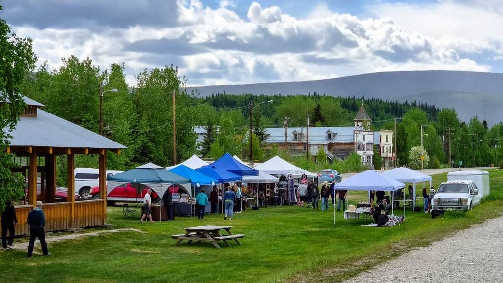
Seventh, one could argue for those remote villages being sustainable or completely unsustainable. Clearly, it is a different type of sustainability than in cities. From a transport perspective, nothing works without cars and electric vehicles remain rare sightings. Next to that, airplanes and helicopters are required to reach some locations or for more urgent transports.
The future vision for Dawson City mentions to grow responsibly with many social and community goals, but the major sources of income remain mining and tourism. Mining changes huge landscapes and requires huge uses of material and energy on its own, while tourists must travel long distances (like me). Tourist guides even recommend flying to Dawson City because distances are too large. This reduces options for surrounding parts of the region further and does not make sustainable tourism any more realistic in a pure sense. I would have deeply missed my visits along the 530 km from Whitehorse: walking around Carmacks (including its boardwalk and the Carmacks Ridge Trail), camping at Lake Laberge, the Twin Lakes, breakfast at the Moose Creek Lodge and the Five Finger Rapids – and not the least the detour to Mayo and Keno City.
On the other hand, those villages are arguably good in reusing materials, in sharing among each other, and in caring for their environment. There is no quick way to order anything by Uber Eats or similar. There is not Amazon next day delivery. Sharing and reusing is a necessity, the same as coordinating with others if someone travels a long distance to specialised shops or services. In some way, this gives a special recognition of the area and the nature around a place. I did not get deep insights into indigenous communities to make further distinctions here, but key ideas of stewardship of nature from there certainly also play a role.

Last, and most sparking from my own interpretations, post-growth perspectives are somewhat desired, but difficult to realise. Naramata is currently one of four Canadian villages who are member of the Cittá Slow movement (two of which are in British Columbia: Cowichan Bay and Naramata). Buying into the slow cities’ movement is a sign for appreciating alternative ways to reach quality of life than rushing for economic growth. When I have been there, the village hosted the Queer Family Retreat, an annual multi-day event. The open, friendly, and kind atmosphere was visible from the coffee in the morning (at Just Baked: food + drink) to walks around. Being at the end of the road may be a good advantage for those who otherwise feel less included.
Nordegg sees tourism reemerging, supported also by the government of Alberta as a destination outside of the National Park boundaries. However, many tourists get here for ATV tours (All Terrain Vehicles, or quads) through pristine surroundings. It did not yet feel any near overtourism but is one of the least sustainable ways of tourism. There was little of an old community left, same as for Keno City, thus the pure existence of these villages today relates to new opportunities, otherwise unfulfilled desires, or also economic needs to find (seasonal) new jobs. New large-scale mining operations might be visible in economic numbers but remain detached from local communities (container villages, fly-in and fly-out employment models, remote open-pit mining locations).
Logging in villages like Tahsis provides some jobs for residents who are there, but is vulnerable due to climate change (wildfires, bark beetles), seasonal labour, and the looming questions of sustainability itself. Dawson City and Mayo show engagement in increasing local food production and urban farming, both to improve affordability and to enhance community. But the growing season is short and conditions harsh, thus it will remain a complementary part to a reliance on larger networks and not getting towards autonomy.
Residents in all the villages I have visited and experienced seem to be proud about where they live and the qualities both the settlement, its surroundings, and its people, have. Internal struggles might certainly be less visible on bright summer days than in winter and less visible to an outsider. Clearly, community support and caring for one another works – deliberately or just due to pure need for it. All the villages host temporary residents for whom it is more difficult to say if and how they are or want to be part of a local community. But overall, it is striking how much happens by few engaged people in the absence of huge economic prospects. And that is a hopeful message in itself.

Future Messages
The quest for long-term self-determined and sustainable futures continuous to fascinate and to puzzle me. What do these diverse locations and communities at the end of the road have to say about our common future? First, it is obvious that there is not the one answer. Second, it may be that exactly this is the answer. I have seen many special places with their unique magic, and it does not do justice to use the same scheme to judge them. I have witnessed friendly and welcoming people and communities that exist and thrive under extreme conditions – at least compared to what I know from central Europe. Boom and bust cycles have led to extreme changes in the past and continue doing so now and into the future.
What happens where the road ends? Some people do not even embark on a journey that has to stop and where to turn is the only option in sight. And where clearly no simple answers and truths lie. However, I feel that those remote villages deserve more attention and a more encouraging connotation on their own terms and besides a tourist’s perspective. We cannot live all in the most central node of transport networks and connections. But if we move out, we jump into inherent contradictions and questions: what are sustainable regional futures? How do our actions (or inactions) impact on remote communities and resources available around them? What gives villages at the edge of attention agency and power to shape their own pathways? We can learn a lot from the end of the road about ourselves, our society, our adaptive capacity, and our hope to cope with current and future challenges.
One of the (to me) most inspiring academics said that science is all about questions and doubt. We tend to forget that and recognise and market science as the mean to identify and implement unequivocal solutions to complex problems. Luckily, democracy remains the best of all available options to deal with real complex societal challenges and make decisions involving conflicts and trade-offs. Moving research to the edges and ends offers richer and more versatile potentials to exploit and alternatives to make available: for research as well as for public and political discussions.
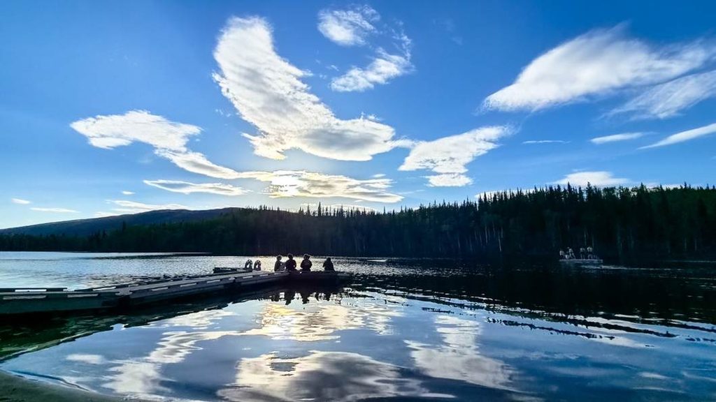
One final key message: spatial planning and futures become especially fascinating where the road ends, and such communities provide valuable lessons for everyone. From Tahsis on Vancouver Island, Powell River in southern British Columbia, through Stewart and Atlin in northern British Columbia to Mayo and Keno City in the Yukon Territory. Geographically at the edge, so do all these examples show a lot about the core of what we need for a thriving society but also about which challenges and threats are looming and require thoughtful action. The “end of the road” is more than a physical location – it is a metaphor for rethinking how we want to live, plan, and thrive in a world beyond growth.
— Christian Lamker, 2026
Download this blog post (PDF)
Acknowledgements: I would like to express many thanks and deep gratitude to many people who were welcoming and friendly all-around Canada. Beyond that, a special thanks to Robin Chang, Rebecca Gunderson, Meg Holden, Kristof van Assche, and Monica Gruezmacher for insights into the Canadian planning landscapes.
Disclaimer: This text was written without support by generative artificial intelligence (large language models) and purely based on my observations and experiences, complemented by online research. Errors are mine. See them as an invitation to continue the discussion.

